The rover was moving, the camera module was capturing clean frames, and the code—at least most of it—was holding up. But something was missing. I needed to know where the device actually was on the field, not just what it saw or sensed. A GPS module would’ve completed the setup, giving me the real-world coordinates to match every frame. That’s when I realized: without location data, all the logs were just… floating.
That moment made me start treating GPS as essential—not a bonus.
What “interfacing a GPS module” actually means
Interfacing is simple at heart:
-
Physical connection—wires, USB, or a stackable HAT.
-
Data flow—NMEA sentences or binary packets streaming into the Pi.
-
Software handshake—services like
gpsdtranslating those packets into usable numbers.
Who needs a GPS-enabled Raspberry Pi
-
Drone pilots mapping crops.
-
Cyclists building DIY bike computers.
-
Makers chasing sub-microsecond time sync for Stratum-1 NTP servers.\
If you track, time-stamp, or navigate, you’re in the club.
What you’ll learn here
-
Pick the right module.
-
Wire it without frying either board.
-
Parse data in Python and even grab PPS accuracy.\
Hardware: Raspberry Pi 4/5, a 3.3 V UART GPS or USB dongle, and a breadboard is plenty. Software: Raspbian (Bookworm),gpsd, and a few Python libraries.
Ready for real-world reasons to add GPS? Let’s dive in.
Why Interface a GPS Module with Raspberry Pi?

I once shipped 100 Pi-powered temperature loggers to a Belgian farm. Their biggest fear wasn’t temperature drift—it was losing crates in transit. A $15 GPS HAT solved that fear overnight.
Strengths of the Pi platform vs. microcontrollers
| Feature | Raspberry Pi | Typical MCU (e.g., ESP32) |
|---|---|---|
| OS | Full Linux | RTOS/Bare-metal |
| Libraries | Rich Python/C++ | Limited, often C-only |
| Storage | GB-class SD card | KB–MB on-chip flash |
| Networking | Gigabit + Wi-Fi 6 | Wi-Fi/BLE only |
The Pi shines when you need heavy data crunching or rich networking. An MCU wins on pure battery life.
When another board makes more sense
-
ESP32: Ultra-low power trackers.
-
STM32: Harsh industrial environments that ban Linux.
-
Jetson Nano: Real-time vision + GPS fusion for robots.
But choosing hardware is only half the story—selecting the right GPS brick is next.
Choosing the Right GPS Module

Form factors & interfaces
-
UART boards (u-blox NEO-6M): cheap, needs wiring.
-
USB dongles (VK-162): zero solder, bulkier.
-
HATs (Waveshare): stack neatly, expose PPS.
-
M.2 cards (SparkFun ZED-F9P): pro-grade, multi-band.
Core specs to compare
| Spec | Hobby-grade | Mid-range | Survey-grade |
|---|---|---|---|
| Update rate | 1 Hz | 10 Hz | 20 Hz |
| Accuracy | 2–3 m | <1 m | cm-level RTK |
| PPS | Optional | Yes | Yes |
| Supply | 3.3 V | 3.3 V | 3.3 V |
Popular modules in 2025 and how they differ
-
u-blox NEO-6M: rock-solid basics, UART only.
-
VK-162 USB: plug-and-play, no PPS pin.
-
SparkFun ZED-F9P: multi-band GNSS, RTK ready.
-
Waveshare GPS HAT: fits Pi 5, gives PPS on GPIO 4.
Cost vs. accuracy
Budget modules nail <5 m accuracy—perfect for asset tracking. Pay extra only if your drone needs centimeter landing or you’re building a lab-grade time server.
Got your module? Let’s wire it before enthusiasm fries a pin.
Hardware Connections & Wiring

Pin-out basics
| GPS Pin | Pi Pin | Note |
|---|---|---|
| VCC | 3.3 V | Some boards allow 5 V |
| GND | GND | Common ground is vital |
| TX | GPIO 15 (RXD) | GPS → Pi |
| RX | GPIO 14 (TXD) | Pi → GPS (rarely used) |
| PPS | GPIO 4 | Optional, for sub-µs timing |
Level-shifting & power draw
If your board outputs 5 V logic, add a simple BSS138 bidirectional shifter. Most modern HATs are 3.3 V safe.
USB GPS dongle
No wiring—just plug and find it under /dev/ttyACM0. Drawback: bigger footprint and often no PPS.
Stacking with other HATs
Use 8 mm headers so RF shielding clears. Check for I2C conflicts if another HAT also uses GPIO 2/3.
External active antennas
Route SMA through a 6 mm panel hole. Keep coax under 2 m to avoid signal loss. Outdoors? Add an IP67 bulkhead.
A tiny LED now flashes once a second—good sign. Time to tell the Pi what’s coming in.
Configuring Raspberry Pi for GPS

Enabling the serial port & disabling Bluetooth
sudo raspi-config # Interface Options → Serial Port → enable, console offTesting raw NMEA
sudo apt install minicom -y
minicom -b 9600 -D /dev/serial0
You should see lines starting with $GPRMC.
Installing and hardening gpsd
sudo apt install gpsd gpsd-clients -y
sudo systemctl stop gpsd.socket
sudo gpsd /dev/serial0 -n -F /var/run/gpsd.sock
Lock it down by creating a non-root service later.
Setting locale, time zone, and log rotation
I keep /var/log/gpsd/ capped at 10 MB with logrotate. Nothing tanks SD cards faster than runaway logs.
The numbers scroll, but raw NMEA isn’t friendly. Python can tidy things up.
Parsing GPS Data in Python

Reading NMEA with pynmea2
import serial, pynmea2
ser = serial.Serial('/dev/serial0', 9600, timeout=1)
msg = pynmea2.parse(ser.readline().decode('ascii', errors='replace'))
print(msg.latitude, msg.longitude)
Extracting useful fields
-
Latitude / Longitude:
msg.latitude, msg.longitude -
Speed:
msg.spd_over_grndin knots. -
Timestamp:
msg.datetime(UTC).
Logging to CSV/SQLite
Use csv.writer for quick prototypes, sqlite3 when the dataset grows.
Reverse-geocoding
Call an API like Nominatim sparingly:
import requests, time
url = f"https://nominatim.openstreetmap.org/reverse?format=json&lat={msg.latitude}&lon={msg.longitude}"
place = requests.get(url, headers={'User-Agent':'PiGPS'}).json()['display_name']
time.sleep(1)  # be polite
Yet timing fans know plain NMEA is only the start—enter PPS.
Using PPS for Micro-Second Time Sync

Why PPS matters
Network Time Protocol (NTP) over Ethernet floats by a few milliseconds. A dedicated Pulse-Per-Second pin cuts that to microseconds—crucial for lab equipment and radio hams.
Wiring the PPS line
Solder the PPS pad to GPIO 4. Add a 1 kΩ inline resistor if you’re paranoid.
Editing /boot/config.txt
dtoverlay=pps-gpio,gpiopin=4Configuring chrony
refclock PPS /dev/pps0 refid PPS lock GPS precision 1e-7Verifying
chronyc tracking should show RMS offset < 10 µs. Anything higher? Check sky view first.
With rock-steady time, fancy projects open up.
Advanced Applications & Integrations

Live vehicle or asset tracking
Pair latitude/longitude with Leaflet.js on a Flask server. Auto-refresh every 5 s for smooth dots.
Geofencing triggers
I once built a warehouse alarm: if a crate left the yard radius, the Pi fired a webhook that lit my phone at 2 a.m.—worth the lost sleep.
Sensor fusion + IMU
Combine GPS with a BNO055 IMU. When GPS drops inside tunnels, dead-reckoning bridges the gap.
Cellular or LoRa back-haul
-
4G HAT: global reach, higher fees.
-
LoRa 915 MHz: cheap, long-range, low data.
A solid enclosure keeps all this tech alive in the rain and heat.
Protecting & Housing Your GPS-Equipped Pi

EMI shielding, airflow, and cable strain
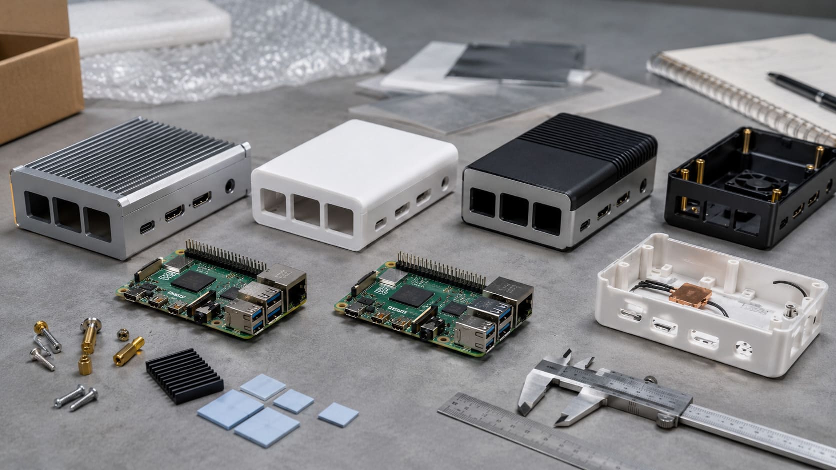
Aluminium dissipates heat. Acrylic shows off LEDs. I prefer a hybrid case: aluminium bottom, clear top window.
Antenna cut-outs & waterproofing
Add a rubber gasket around the SMA jack. A dab of silicone in the screw holes goes a long way.
Branding tips
-
Laser-engraved logo on the lid.
-
Color-matched screws to stand out on Amazon thumbnails.
-
QR code etched inside for quick manuals.
OEM/ODM scaling
Need 5,000 units fast? We switch from CNC prototypes to injection-moulded ABS, drop unit cost 30 %, and still slip your brand under the clear coat.
Even with tough shells, quirks pop up. Let’s squash them now.
Troubleshooting & Optimization

“No fix” or intermittent lock
-
Move the antenna away from metal.
-
Check for 3.3 V sag under load.
-
Cold-start can take 30 s—be patient.
Serial permission errors
Add gpsd to the dialout group or tweak udev rules.
Speed vs. power
Drop update rate to 1 Hz with a $PMTK220,1000*1F command to save 50 mA.
Indoor accuracy hacks
Assist with AGPS (u-blox online almanac), or triangulate Wi-Fi SSIDs as a fallback.
That covers the bumps; time to wrap things up.
Conclusion

We wired a module, parsed clean data, nailed micro-second timing, and even wrapped it in a branded shell. Whether you’re Davide aiming for slick retail stock or Jacky customizing small batches, the steps stay the same:
-
Pick the right GPS.
-
Connect safely.
-
Configure
gpsdand, if needed, PPS. -
Code your parser.
-
Protect the build for field use.
Need deeper help? Check u-blox docs, gpsd manuals, or the Chrony FAQ. And if you’re ready for bulk orders or an OEM makeover, MaidaTech has stock on the shelf, lasers warmed up, and a nine-year head start on getting cases right.
Let’s build something that knows exactly where it stands—literally.